
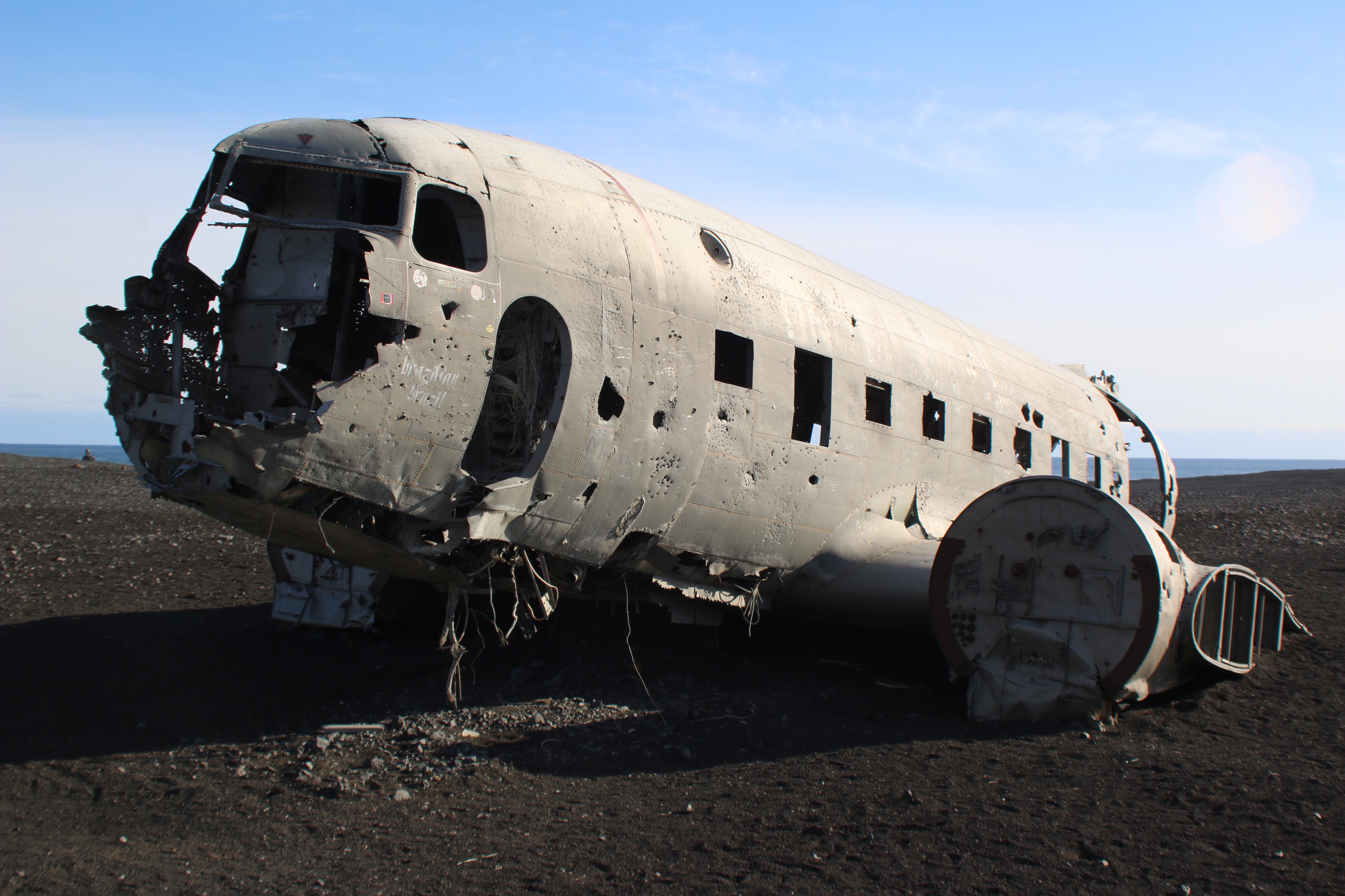
Wednesday we parked off of the Ring Road just west of Vik and walked (a very long) two miles to a US Navy plane crash site. The plane ran out of fuel and crash landed on the beach in 1973, with no casualties. The fuselage was left on the beach and remains there to this day.
I first heard of the crash site from a shared Facebook post last year. When planning our trip, I absolutely wanted to make the stop to see it, and I’m glad we did. The beach the plane is on can only be described as “otherworldly”; it looks exactly like what I would guess the surface of the moon is like, with gravel and sand everywhere and mountains in the background. There was a trail leading from the road all the way out to the crash site, which I assumed was where cars were once able to drive. The road is now blocked off, so we parked and walked, along with many other tourists.

You can’t see the plane from the Ring Road, or even while walking. Once you get within ten minutes of it, you start to see it poking up behind rock mounds with the ocean not far in the distance. And when in full sight, the ghostly remains make the hour-long walk worth it:
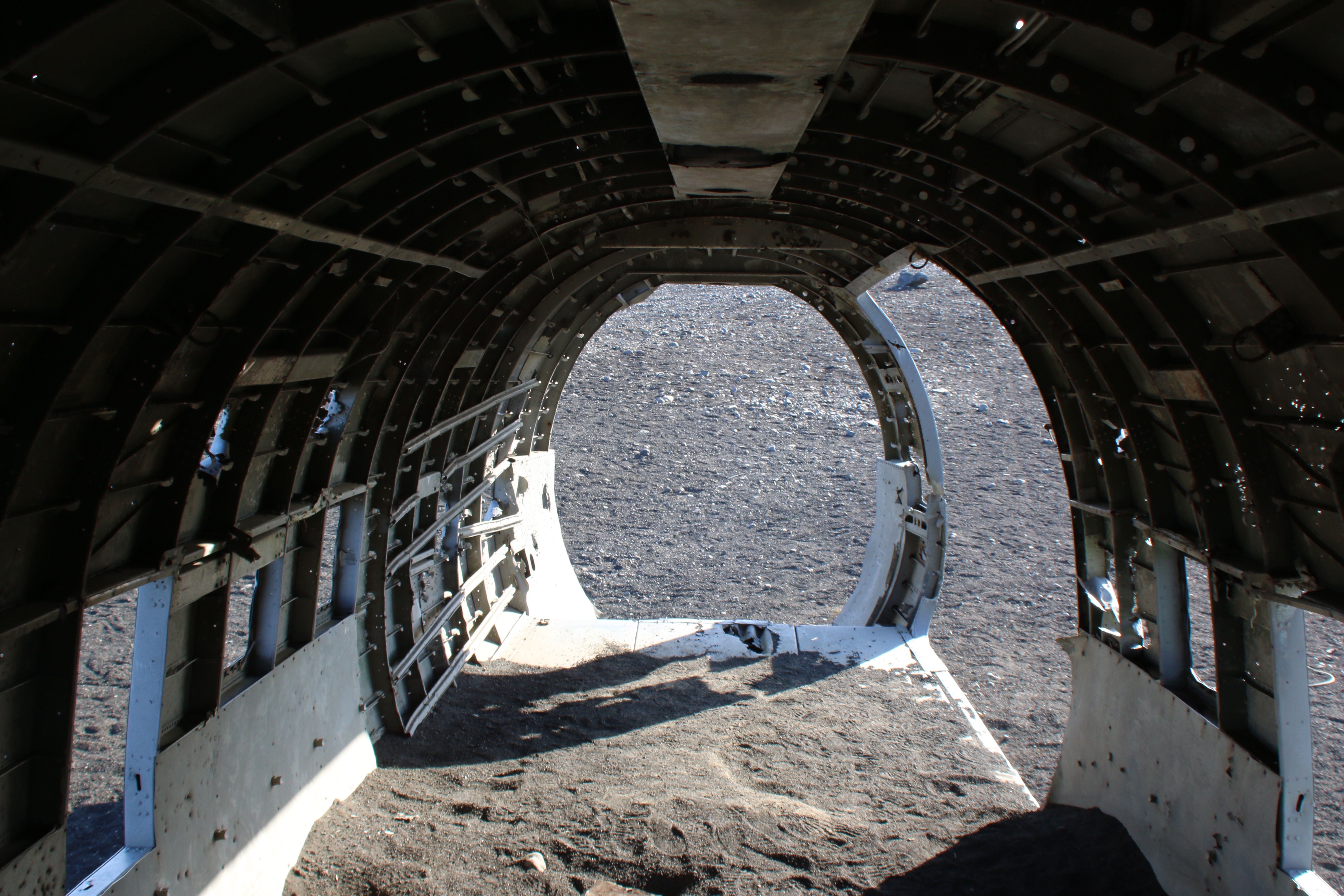


After a good twenty minutes of selfies and exploring, we headed back to the car. The sky was clear and I actually got a bit of sunburn on my face. Note to self: remember the sunblock the next time you’re in Iceland.


Hi,
I plan to visit there in first 10 days of July 2016. Please can you help me with additional information.
1. I hope the landowners do not fine us if they find us walking all the way there ?
2. Also, can you tell me how to reach the place to park the car, what to search in Car GPS ?
3. Is there a sign anywhere nearby to stop and identify that it’s the place to stop ?
thanks,
Ahmad Cheema
00971554051774
LikeLike
I don’t know who the landowners are, but I don’t believe they mind that tourists are visiting the plane on the beach. There is a sign on the side of the road with a small parking lot saying the plane wreckage is 4km ahead. We found it with the help of Google Maps. The exact coordinates of the parking area are
63.4911° , -019.363°
Hope this helps!
LikeLike